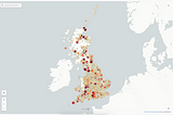
PinnedPublished inThe StartupFinding the most remote buildings in Britain.A geospatial big-data challenge using PostGIS, QGIS and open-source data.Nov 19, 20193Nov 19, 20193
Finding which cities share the same Latitude & LongitudeUsing QGIS Geometry GeneratorsOct 15, 2024Oct 15, 2024
Spatial SQL 101: Should you ever GROUP BY geometry/geography?TLDR: Probably not, unless you are sure of what you are doing!Feb 2, 2024Feb 2, 2024
Doppelgänger GeographyFinding duplicate place names across Great Britain using BigQuery & CARTO.Jun 12, 2023Jun 12, 2023
Open Street Map FootprintsA look into the edit footprints of some of the worlds largest corporations on Open Street Map using CARTO & BigQuery.Jun 12, 2023Jun 12, 2023
Advanced Spatial SQL: Window FunctionsHere we will use the NOAA Global Hurricane Tracks dataset, freely available as a BigQuery public dataset. It is a point dataset containing…Dec 15, 2022Dec 15, 2022
Published inThe StartupThe Coastline ParadoxStatistical Self-Similarity and Fractal Dimensions.Jan 8, 2020Jan 8, 2020